Day 24: Greenland Expedition Full of Cold and Surprises
Listen to the Expedition Greenland Update
Sign up for the Expedition Newsflash.
Receive alerts of new blog posts in your email during the expedition.
Day 24 of the Greenland Expedition: an Icy Start and Unexpected Discoveries
On day 24 of our expedition in Greenland, we were greeted by an unprecedentedly cold morning. It was Saturday, September 6, 2025, and the temperature outside dropped to minus 20 degrees Celsius. In our tent, where I stayed with Ronnie, it wasn’t much warmer with a temperature of minus 15 degrees. Despite the cold, we started the day early and set off at five past six, almost a record time for us. The first three shifts were challenging due to the cold; my toes and fingers felt icy. Nevertheless, we persevered and had to zigzag our way to avoid the many lakes on our route. Thanks to detailed preparations with Google Maps and Bing Maps, we had plotted all the rivers on our route into the GPS, which helped us bypass these obstacles. However, we had to cross one frozen river, reminding us of how dynamic the landscape here can be.
An Encounter with Technology and Nature
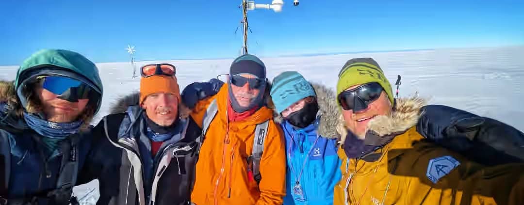
During our journey, we reached a remarkable point around noon: the weather station of Dirk van As. Dirk, our meteorologist and Basecamp Manager, works for the Danish equivalent of the KNMI. Seeing this autonomous measuring station was impressive, especially compared to the abandoned radar station Dye-2 we visited earlier. While Dye-2 was once manned by hundreds of people, this weather station operates entirely independently. It’s fascinating to think that Dirk can easily monitor the weather conditions in Greenland from the Netherlands. After a short break at the weather station, we continued our route with a new course of 303 degrees westward. And then something unexpected happened: at four minutes past one, we finally saw land on the horizon. After 23 days without seeing solid land, the mountains were in sight. Although they were not yet the mountains we were heading to, it was an encouraging sign.
The Challenges of the Greenlandic Landscape
Along a large lake, we continued our journey and eventually set up camp next to a large river. This river was dry in 2023, but now water flowed through it. This meant we had to adjust our route for tomorrow, as the original route went through this river. For those curious about our location: you can zoom in on our route map on Google Maps to see in which maze of rivers and lakes we find ourselves. Today we covered a distance of 30 kilometers, bringing our total to 519 kilometers. We are now at an altitude of 1129 meters. Our next goal is Point 660, still 39 kilometers away as the crow flies. Although that doesn’t seem far, we know that nothing here goes as the crow flies. We expect to need another three days to reach our goal. More news about our progress will follow tomorrow!



Leave a Reply
Want to join the discussion?Feel free to contribute!